Exploring Maps
In cartography, a map is any two-dimensional graphic representation of the spatial relationships of the whole or a part of the earth. In digital cartography as in MapStore, a map consists in overlaying various layers of geographic data and their styles in data frames, and it contains various map elements such as a legend and a scale bar.
In order to create a map, the user can click on the New Map button ![]() in Homepage and will be addressed directly to the map viewer (by default only Administrators and Normal Users can create a new map, as explained before in Homepage section):
in Homepage and will be addressed directly to the map viewer (by default only Administrators and Normal Users can create a new map, as explained before in Homepage section):
Once a map is created and saved, it will be available in Homepage content section.
MapStore WebGIS Portal Interface
The Mapstore WebGIS Portal interface is composed by the following main blocks:
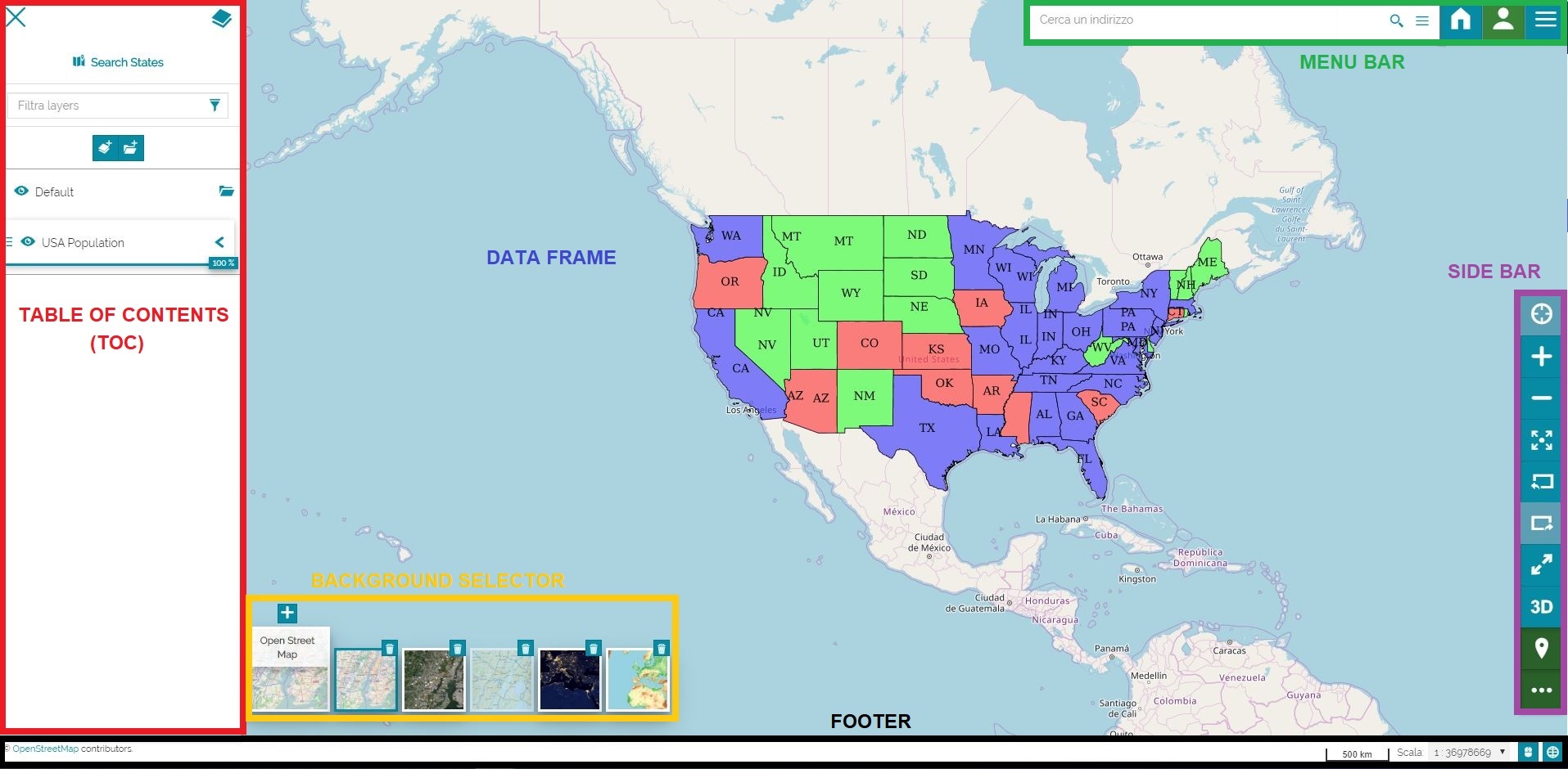
In particular:
-
The Table of Contents (TOC) shows the layers and the layers groups on the map and allows to remove or edit them, and add some new ones
-
The Menu Bar includes the Search bar, the connection to the Homepage, the login window and the Burger Menu, an important list of options that contains several functions and information
-
The Sidebar that is mainly a navigation panel
-
The Background Selector allows to add, remove or edit map's background
-
The Footer includes the CRS selector, the coordinates, the scale and the credits of the layer
-
The Data Frame is the space where the layers are displayed